in my last post, i mentioned the downside to using the NOAA's paper charts or online chart viewer when prospecting for inshore fishing spots. what i like to do is overlay the NOAA charts onto Google Maps or Google Earth.
here is how to overlay the NOAA raster navigational chart (RNC) on top of Google Maps:
1. go to the NOAA's interactive RNC catalog, and select the area you want to fish.
2. on the right, you will be able to choose if you want to download the RNC file, buy a paper map, or view the chart online. download the RNC file to your computer.
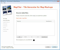
3. go and download the beta version of Maptiler, which is a graphical application for online map publishing. Maptiler allows you to take the downloaded RNC files and create an overlay for Google Maps.
4. open Maptiler, and select 'Google Maps compatible'. hit 'Continue'.

5. click 'Add', then find and select the .KAP file you downloaded from the NOAA.
6. hit 'Continue'.
7. At the screen that says 'Spatial reference system (SRS)', just skip by clicking 'Continue'.
8. again, skip the screen that says 'Details about the tile pyramid' by clicking 'Continue'.
9. choose the 'Result directory' on your computer. this is where the necessary files will be created.
10. hit 'Continue'.
11. choose which viewers should be generated. i click both 'Google Maps' and 'OpenLayers'.
12. hit 'Continue'.
13. you can title the map file anything you want.
14. since the development of this Maptiler application, the Google Maps API key is no longer 'optional'. you need to get a Google Maps API v3 here. once you get your API code, enter it in this screen.
15. hit 'Continue'.
16. on the last screen, 'Tile Rendering', hit 'Render' at the bottom right.
17. once the application has finished, find your new created files, and double click on the googlemaps.html file. this will open up your NOAA map on top of Google Maps! from here you can search for all the optimal places you want to fish. what i like to do is create a PDF of the new map, make some notes on top of it in Adobe Acrobat, and then upload it to my iPhone so i can access it on the water. if you are worried about using your iPhone on the water, you can just print out the new map and now you have a printed NOAA chart for free! for FRREEEEE!
my next goal is to somehow get the generated files and access them on my iPhone so i can have all the soundings on my mobile Google Maps. essentially that would create a duplicate GPS device, again...for free! for FRREEEEE!
also, if you want to keep track of all your waypoints and GPS tracks on Google Maps, you can convert your .GPX files to .KML files using the website GPS Visualizer. once you have your .KML file, you can upload it to Google Maps or import it into Google Earth.
in part 3, i will go through the steps of creating an NOAA overlay using their electronic navigational charts (ENC) for Google Earth. this process is a bit more complicated, but gives you greater flexibility as to the data you want to access.


No comments:
Post a Comment